Full-Scale Overview
Full-Scale Overview
- Enrico Bonaiuti
Owned by Enrico Bonaiuti
Last updated: Aug 28, 2017
The overview consists of a complete atlas, zoomable to the ground level, provided with street view. The user can choose between “map” and “satellite” perspective.
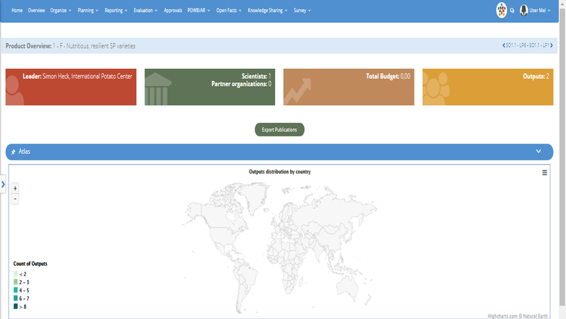
The map highlights active flagships by implementation area. Clicking on the target area, the user will visualize the overview of the flagship active in it, as well as information on related clusters, projects and indicators.
The expandable tree on the left side of the screen also provides direct access to the overview of flagships, clusters, and projects, organized by CRPs and Centers implementing MEL.